Friday, April 26, 2013

Arrowtown's True Autumn Colours

When I left Te Anau the other day, I did so without a plan. I had a relative destination in mind, but that's about it – if I ended up on the road to Queenstown or not, it wouldn't be the end of the world. I headed out to where the road from Te Anau met the road from Manapouri, and there I set about hitchhiking.

When myself and Dorothée got picked up earlier this week, after the Gertrude Saddle hike, one of the passengers in the car remarked, “Oh, hitchhiking and Couchsurfing? That's pretty cheap.” I didn't read too much into it (partially because they were sleeping in their car along the side of the road rather than pay $6 to camp in a serviced area, so her preachy condescension was bullshit in a tacky disguise), but it warrants a bit of discussion to clear the air. Admittedly, I'm saving a heap by hitching through the South Island of New Zealand rather than take a bus. But that's not why I'm doing it. At first, it was for an experience – I would never have even considered it in Newfoundland, and I did it for a lark, one of these exotic experiences to tick off the list. But now that I'm into it (21 rides is my current count, and I still call that a relatively modest number), there are other reasons as to why I still do it. Part of it is to reduce costs, and part is to maintain this romantic idea of hitchhiking across New Zealand, but then another part is to meet and interact with cool people who I never would have met otherwise. And so that's why I hitched out of Te Anau with no set plan.

A few minutes before I got picked up (having waited on the outskirts of town for close on two hours), I got a phone call from a woman in Arrowtown who was looking for a WWOOFer. Yes, I had no destination when I left Des's in the morning, but I had emailed a few hosts in the Queenstown region the night before. Hilary and Graeme run a cozy, home-style accommodations spot in the small town on the cusp of the adventure capital, and they were looking for someone to pitch in around their home for a few days. I scribbled her name, phone number, and address on a gum wrapper, and assured her that if I made it as far as Arrowtown that day, I'd stop in.

Soon enough, I got picked up by a German beekeeper (I can now explain the honey making process, and tell you a bit about Manuka honey, too), who brought me through the rolling hill country, along the shore of the very blue Lake Wakatipu (the coldest lake in the country, if the guy at the pub is to believed), and back to Otago. He was bound for Queenstown, but left me at the busy intersection of Queenstown and Wanaka.


I walked a few hundred metres down the road, to one of those signs than list a bunch of different destinations and their distances. Arrowtown was at the top of the list, so I decided to point to it, mostly to assure any passing motorist that if they decided to pick me up, the longest they would have to put up with me would be 15 km. Only problem is, those signs are a lot bigger than you'd think, once you're next to them, and I'm what some would call vertically challenged . . . so I took out my hiking pole, extended it as far as it would go, and stood on tiptoes, one arm stretching up as far as it would go, the other trying to flag every passing car.

A few minutes later, the least amount of time I've yet had to wait, a family heading to Alexandra stopped. “Did my gesturing work?” I asked as I jumped into the backseat.

“Naw,” he said. “We just thought you looked funny.” I'll take it.

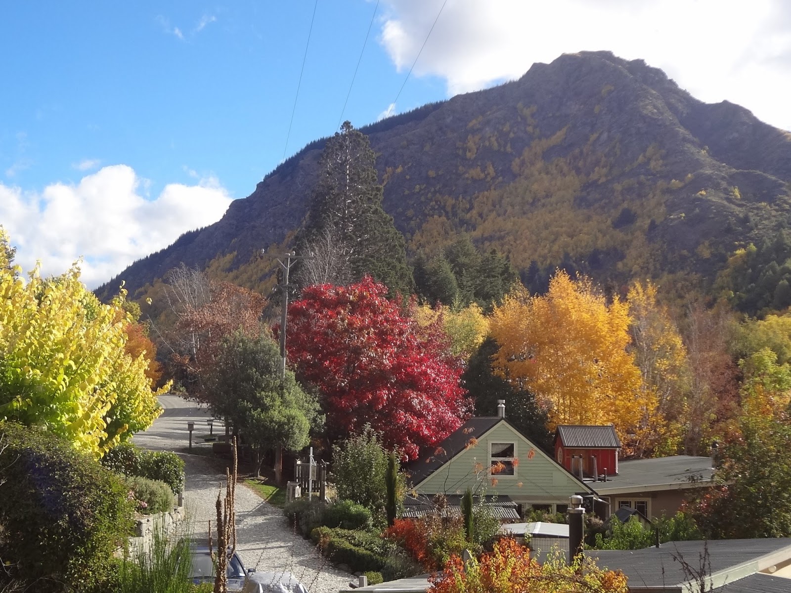
He brought me a bit farther down the road, to the turnoff from the highway. I had a bit of a walk – but what a walk it was. Sure, I tried to hitchhike, but I didn't really want the first car to pick me up, or even the second. That's because there aren't a whole lot of deciduous trees in New Zealand, so the autumn I'm used to in Canada has been hard to find – however, here it is, in the core of the South Island. Walking alongside Lake Hayes, there were trees painted yellow, red, and gold, a harvest mosaic on a sunny day. And y'know that smell that there is on a dry, sunny autumn afternoon? That was there, too.


Eventually I did get picked up, and the grandmother who stopped brought me right to the front door of Pittaway's Cottages (B&B says the sign – bed and bugger off, they say) on Buckingham Street, the main street through the tiny town of Arrowtown.


In 1861, gold turned up in the gently flowing stream of the Arrow River, and all of a sudden a gold rush near equal to the excitement of the Yukon brought people from all corners of the globe to central Otago. Arrowtown boomed overnight, and when the gold dried up (though you can still rent panning equipment – someone in 2006 ended up finding a chunk worth $15,000), the town shrunk. Today, it looks like a preserved, historic tableau out of a John Wayne movie from the Wild West – a quiet street, innocent storefronts from the 1800s (one of them is even a telegraph office), and the trees cushioning every avenue.


The trees. The gold rush these days is for the leaves – admittedly, I missed the 150 anniversary of the gold by about a year and a half, and came a week late for the Autumn Festival, but my timing was still inadvertently awesome. Arrowtown is alive with autumn, a once a year treat that I happened to stumble upon.

 
My lodgings for the next few nights are in a loft above one of the guest rooms, a spacious junk room. Hilary and Graeme are semi-retired, in the midst of a couple of different projects around the house. Not that it's particularly stressful – all I had to do when I arrived was join Graeme, a self-described cantankerous old fart, in a few beer and a chat while he smoked a cigar, and when I finally slunk off to bed I was told that they were not early risers, so get some breakfast and take it easy in the morning. Deadly.

After helping put together a greenhouse this morning (broken up soon enough by a coffee break), I went to the other end of town (a lot closer than that statement implies) to pick up for some pies for lunch. Man, I'm taking these crispy pies, stuffed with everything from venison to butter chicken, for granted – you don't get them like this back home, and I daresay I'm going to miss them in a few months. For a small town of about 2000, Arrowtown was pretty busy yesterday – it's the school holidays (a two week break for students between terms), not to mention that it was Anzac (Australian and New Zealand Army Corps) Day, the national war remembrance day on the anniversary of the landing at Gallipoli, a major disaster for all of the Allied Forces but particularly devastating to the Australasian troops.

After lunch, I went down the bustling avenue, to the Chinese Settlement along the quietly bubbling Bush Creek. Cramped, restored stone buildings are a testament to the difficult living conditions of the early Chinese settlers during the gold rush – it's a lot less pretty than the frozen-in-time, idyllic main centre of historic Arrowtown, but it's fitting, considering how hard things would have been for them (the 19th century isn't exactly known for its progressive, non-racist attitudes).


There are a heap of nature walks in this part of town, branching our from the Arrow River – I went along Tobins Track, a gravel road that climbs up one of the brightly painted hillsides flanking the community. What a treat for the eyes. Right from the trail through Wilcox Green, there are so many directions to look in, even when it's just a simple woods path. I thought this looked cool – not realizing until I got back that those arched trees were the very same ones that Isildur rode (and got ambushed and shot) beneath in The Fellowship of the Ring:


From up the hill, you could look out on the flat Wakatipu Basin, from the compact settlement as far as Lake Hayes and the Remarkables on one end (the iconic mountain range – why do you think they're called that?) and the Crown Range on the other. It's no surprise that Arrowtown has one of the most inland climates of anywhere in New Zealand – it's tucked right away in a sizable valley, safe and secure.


I haven't seen real autumn colours like they have in the Humber Valley in Newfoundland for a few years – I found it in Arrowtown. This is a pretty special place, small town New Zealand, only a short drive from Queenstown if you want your city lifestyle and nightlife. God knows I didn't come to this country on the other side of the earth to find a place to raise a family, but if I did . . .


That night, it was off to the Fork and Tap, a pub just 240 steps down the street. Myself and Graeme went out before dinner for a few pints with some of the local characters who tend to converge at the watering hole (the smallest towns have the best characters – one of Arrowtown's is Ernest Hemingway’s nephew, and apparently he's a bit of a prick with a famous last name. Their words, not mine). It was surprisingly busy for a Thursday night – with more than a few other old farts, but who's complaining?

 
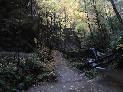
Just around the bend, I bet Queenstown is pretty rollicking on a Friday night, but here in Arrowtown, the rainy afternoon is slowly turning into a quiet drizzly night – once the weather cleared a bit (I have a friend back home who would call this the perfect weather for eating stew), I went for a stroll along Bush Creek, through the forest along a damp carpet of gold.



Graeme told me that there is a difference between a tourist and a traveller: the former is led by the hand with no stress, while the latter immerses themselves in a new world to have an experience, their main objective survival. That doesn't mean they don't have fun in the meantime. Every day, I identify more and more with the traveller, and feel sorry for those people walking around with the guide books and cameras in front of their face – they're the ones who'll go everywhere and see nothing. They're the ones who'll have a three course meal, but never a home-cooked Kiwi dinner in front of the fireplace on a cool autumn evening.

Cheers,
rb

Wednesday, April 24, 2013

Hitching to the End of the Road

I've done a bit of hitchhiking in the past few days, and it left me with a genuine curiosity as to what someone's reasoning would be for stopping to let a stranger share a ride with them, but more importantly, why people don't stop for a hitchhiker. Most don't, and I don't think it's a safety thing. I assume that most drivers don't even entertain the thought – it's not a “should I or shouldn't I” dilemma, just an assumption that someone else is the type to pick up a hitchhiker on the side of the highway, but surely not me. And I don't say that in a judgemental way – sure, there aren't a hell of a lot of hitchhikers in Newfoundland, but there are a few, and I've always passed them with only a cursory thought (if that). Anyway, just some musings.

The road from Te Anau to Milford, some 100 km, is a lonely stretch through open fields, ancient forests, and towering mountain ranges. It's beautiful, but there's snow on the peaks, leaves on the ground, and a coldness setting in – the summer traffic has gone home, and this 100 km stretch of Highway 94 is really only used as the route to some hiking tramps and Milford Sound. In other words, there aren't many cars going by. I assumed that, for the infrequent driver passing you by, there's a millisecond thought process that says, “Here's a fellow traveller, heading up to do some traveller activity (maybe the same one as me), and who knows when the next car passing through will be?” That's followed by a release of the gas and pulling over to the shoulder.

Turns out that's not really how it goes.

Myself and Dorothée set out on an overcast Sunday morning to hitch up to the start of the Routeburn Track, another of New Zealand's Great Walks. We weren't loaded down with sleeping bags and supplies to head into the bush for a few nights – the Key Summit is a three hour side trip, a 900 m bump with an alpine circuit that looks out over some glacial river valleys, mountain peaks, and Lake Marian up in a hanging valley. I done embarrassingly little tramping since I came to this country, but now that I've started, I've been inspired to pack my bags and get outdoors. DOC has said that, if you've only got time for one trek in the Milford area, make it this one. So be it – but we had to get there first.

After an hour of no luck, we decided on a new strategy – maybe the cars weren't stopping for two, so we'd separate, with me heading further down the road. When you're standing on the side of the road with a thumb in the air, it's much easier to be a girl – ideally, Dorothée would get picked up and have just enough time to make an introduction and entice the driver to pull over just around the next turn.

Soon enough, we were clipping away with a tourist couple – from Germany, of course. What a drive. Not surprisingly, there wasn't a whole lot I could contribute to the conversation, so I had a chance to have a gaze out the window at Fiordland unfolding around me. We passed the 45 degree south line, the mid-point between the Equator and the South Pole if the earth was a perfect sphere (it isn't), as well as the Eglinton Valley, a sprawling stretch of lowland bordered by a steep, rocky enclosure of humility. Spin it any way you want, we're pretty small in a great big world.


The climb to the Key Summit took a little over an hour, with wispy clouds shielding some of the more distant edges of the mountains but still giving a decent view for a lunch break.


Along the way back, near the edge of the afternoon, we took a slight detour to Lake Howden, where the first hut of the Routeburn sits beside the sandfly speckled lake. After a quick look around, we figured it was time to start trying for a ride back to Te Anau.


North of Te Anau, there aren't many places to stay – a few lodgings in Milford, right at the mouth of the sound (which is technically a fiord), and some campsites along the road. That's it, so once the day's activities are over, everyone comes back. That means there's guaranteed traffic – of course, it also means that once those cars have gone, they're gone. We stood by the beginning of the Routeburn, on a bend in the road, for a long enough time for us to seriously wonder what we'd do if we couldn't get a ride (probably stay in the Lake Howden Hut). A couple came down from the track and, getting desperate, we started up a conversation that ended up with us riding along as far as a hotel at Te Anau Downs, about 30 km north of Te Anau. By now, it was dusk – the guy offered to drive us the rest of the way, but knowing it was making him go out of his way, we decided to at least try hitching for half an hour, and knock on his door if that failed and actual dark set in.

We'd pretty much given up and were waiting five more minutes, until 7:00, when a camper-van pulled over.

Yesterday morning had a similar forecast, although we made sure to get a move on a bit earlier. By 9:00 we were back along the same stretch of road, with the same strategy. I waited on my own further down the route, and it still took a while, but a French IT specialist eventually let her join him on his way to Milford, and slowed down for me too.

The road gets good and winding and narrow past the Routeburn, as you get deeper into the Southern Alps. We were equipped for the Gertrude Saddle this day, a longer hike (4-6 hours return) that was also considerably more difficult, going up a steep mountain pass along an unmarked route. Clearly it's a less touristy route – we drove right past the Gertrude Valley first, ending up at the Homer Tunnel, a 1.2 km road that goes right through the Darran Mountains on the way to Milford. 


Eventually we found it, along with clear warning signs to have your wits about you, and an equally important warning from a warden that a few trampers got lost and ended up setting up an impromptu campsite the night before, and that the fine day would shift to rain by this afternoon. It was just past 11:00 when we set out over the rocky river valley to the foothills.


Even knowing it was unmarked, I was surprised at how little DOC had done to establish a trail. I don't mean that in a neglectful way – this was just a different experience, an immersion in the wilderness rather than a sugar-coated walk. A few metal posts let us know we were on the right track, until we accidentally missed the woods trail and scrambled along rocks in the dry river bed. We still aimed our course in the right direction, but it took a bit longer.

When the wide valley turned into a steep climb, the day was still looking good, with some awesome views of staggering heights and snow in lofty nooks. We had a snack break on one of the mini-plateaus that opened up along the rise, surveying the scene and catching our breaths before it was back to craning our necks at what lay ahead (and above) of us.


I said the trail was unmarked, but that's a bit of a lie. As far as DOC signposts go, it is, but plenty of other travellers before left stone cairns to show us the way, up over rock ledges and dips. Obviously the only way was up, but the markings were pretty necessary to find the safest footings and most sensible path. 


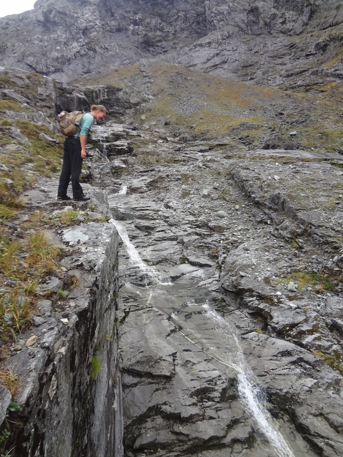
A glassy waterfall ran alongside us part of the climb, fed from Black Lake in the reflected shade of more mountain peaks (they don't seem to end). The large boulders were easier to hop from than the long smooth rock faces that made up this part of the climb, where you had to inch your way along slowly to make sure your shoe grips didn't fail you and you slipped. One close call later (once you start to slip, there aren't many places to grab hold of), the cairns led us to a wire rope that made the next little climb a lot easier (and safer) by giving us something solid to hold onto and hoist ourselves up. It turns out the rope was even more useful when making our way down the mountain, but we didn't know that at the time.


Somewhere below the snow line but into a true mountain setting, the drizzly rain and wind started. Just in time though, we made the final push to the saddle, and the view of the valley over 1000 m below and Lake Adelaide just on the horizon. Deadly place for a peanut butter sandwich.


Going down was quicker, but only marginally, especially since the rock faces were getting a bit slippery. When we made it to the river valley, we found the spot where we had veered off course, and made sure that the next group wouldn't make the same mistake by adding one more cairn to the dozens already dotting the Gertrude Valley and ascent.


Again, you'd think two people who had clearly been hiking, here in the middle of nowhere, would be perceived as a zero threat to a passing motorist, who would recognize that, being in the middle of nowhere, it would be a decent thing to give them a ride. Again, not really. We even had signs to help us, but the sky was still getting darker when a group of backpackers finally stopped. It was dark again when we made it back to Des's for some pumpkin soup with a whole new crowd of faces.


Third time is the charm they say (admittedly, first and second time were pretty good) – the two of us were back on the road leading out of Te Anau this morning again, along with Simone from the Netherlands. Having three was an added challenge, but far from impossible, especially since it was early and the boat cruise leaving Milford Sound was after 1:00.

Ok, Milford Sound. Piopiotahi. This was something that I've been on the fence about doing for weeks. If you know one thing about New Zealand, it's that Lord of the Rings was filmed here. If you know two things, it's that and the fact that the Flight of the Concords are the fourth most popular guitar-based digi-bongo acappella-rap-funk-comedy folk duo from here. The third thing, though, is that the Milford Sound cruise is something that you should totally do.

I guess I was a bit worried that the whole thing would be too touristy and over-hyped, as the most popular destination in New Zealand. What you've got is a 15 km fiord cutting into the Tasman Sea and lined with cascading waterfalls and mountains (the 1692 m high Mitre Peak, visible from the shore, is one of the most photographed peak in New Zealand). The “town” of Milford is really just a street with a booking centre and dock – if you come to Milford, you're going into the Milford Sound, whether by boat, helicopter tour, or some other over-priced way.

Fiordland is one of the rainiest places in the world – fact. We're talking about 180 days of rain a year, and Milford Sound gets, on average, 7 m of rain a year. In one day, it can get more rain than some places get in a full year. I've heard that the cruise is nice, even in dreary weather (imagine the force of the waterfalls then), but if I was going to do it, I'd want to do it on a decent day.

Anyway, the three of us made it to the start of the Routeburn with one driver (he was full of hitchhikers, stopping for a German girl as well), but we had to divide for the rest of the way, with myself and Simone cramming into the back of a rented van.


The sun was shining and the sky was blue at the head of Milford Sound, and we got onto the first Jucy Cruize of the afternoon, a smaller boat amongst a half dozen other vessels in the marina. I didn't want to end up back in Canada in a few months and regret having missed out on a renowned experience, especially having been so close on such a perfect day. I'm pretty glad we ended up cruising into the sun.


There was a gale on the decks, but what a view. You get a hint of it from the harbour, but actually immersing yourself in it, tilting your headback to see these peaks – it's something else, something pretty special. We went as far as Dale Point, an outcrop of land that serves as the last buffer before the open ocean.


Heading back, we passed a rock of sunbathing seals; got a shower in the mist of Stirling Falls, a curtain falling 155 m that is one of two permanent waterfalls in Milford Sound; and watch a rainbow paint the opposite hillsides as we rounded the last bend to bring us back to Milford.


The rain didn't start until we were nearly back in Te Anau, and by then it didn't matter. We'd already had a pretty fantastic day in Milford Sound.


Te Anau has been a base camp that has permitted me to play in Fiordland to my heart's content. You could spend ages here, exploring all the paths (and even more ages going where there are no paths), but my time in this neck of the woods is drawing to a close, especially now that some nasty wet weather is making its way down from the north (Nelson was just battered by some flash floods). Autumn in Arrowtown is supposed to be spectacular, and Queenstown is an untamed playground of frivolity and bad decisions any time of the year – and both are right on my way, wherever it is that I'm going.

Cheers,
rb